Eastbound Log

(Dates in reverse order.)

May 6, Thursday:

Drove across Virginia, a sliver of West Virginia and a sliver of Maryland before crossing the Mason-Dixon line into Pennsylvania.  Filled up in Gettysburg.

1514 EDT West Virginia at 2913.4 miles.  (mobile 8)
1606 EDT Maryland at 2957.3 miles (mobile 3)
1617 EDT Pennsylvania at 2969.2 miles
Total distance to Franklin and Marshall College is about 3060 miles (when you go by way of Texas).

Tomorrrow (5/7) is packing day, for everybody.

May 5, Wednesday

(Like I can tell it is Wednesday!)

0915 CDT Tennessee at 2039.8 miles.  Switched from "mobile 5" to "mobile 4".
1652 EDT Switched to EDT at 2437.1 miles.  Called Viannah with the news.  The cellphone switches itself soon as it hands off to a cell in the new area.
1942 EDT Virginia (now on I-81) at 2594.1 miles.

No new pictures.  I nearly got a picture of a barge on the Mississippi River, but, given the choice between that and negotiating with a truck in the next lane, well...

I'm getting tired of doing all the driving too.

Started out about 15 miles from Memphis, TN.  Ended up about 15 miles into Virginia, so spent most of the day in Tennessee.  It is nearly as wide as Texas but not nearly as tall.

Imagine a great forest of 50 foot trees on rolling countryside, then cut out a freeway, sometimes exposing even sedimentary layers of rock.  That's what most of Tennessee looks like from behind the wheel, except for the occasional city (hidden in trees, but you can tell from the rush hour traffic and construction) and rivers.  Rivers here have water in them.  Considerable water.  What's that all about?

Virginia has lots of rules.  "Radar detectors are illegal," for example.  Believe it or not, I've never owned or used a radar detector.  Really.  You think they'll believe that when I explain my ... antennas?  Business are located in "Approved Business Zones."  Good idea!  When you merge onto the freeway you are prohibited from moving left immediately.  Not a bad idea, I guess.  Wonder what else?  Then it occured to me,  Hmmm, Pat Robertson lives here, albeit clear across the state...

Lots of construction.  When you enter Arkansas, there is a sign that says, "Four Construction Zones in the next 200 Miles.  You will be Fined."  Tennessee should have signs saying where there is not construction.  They would be fewer.

I'm in Abingdon, Virginia for the night.  Very pretty place.  I stopped as sunset so as not to miss anything.

May 4, Tuesday:

Left Hillsboro at 1010 a.m. CDT, 1499.9 miles.
Headed northeast, decided to go by Paris, where I was born and Roxton, where I was baptized.
Hey, how often do you get close enough to Paris, TX to stop in?
We moved before my first birthday so this is only about the fourth time I can remember being here.


The parking lot in the foreground is the location of
St. Joseph's Hospital where I was born.  It was
replaced with this new building 20-25 years ago.
During the last year, the facility was bought out
and the name changed to "Paris Regional Medical Center"
Everywhere you look there are bags over the
old signs with the new name.


First [United] Methodist, Roxton.
Dad was pastor here.
I was baptized here.
Roxton is not easy to find!

(Long story.)
Arkansas at 1916 CDT, 1818.4 miles.  I'm in Earl, Arkansas tonight.  W0RPK and I are pretty much only on 40 meters.

May 3, Monday:

Trimmed trees and plants around the house.  Cinder (cat) helped.


May 2, Sunday:

Went to church at Hubbard UMC.  Alice Ruth, mom, and Bennie in Bennie's kitchen.


May 1, Saturday:

Moved furniture:


April 30, Friday Evening.

Navigation today is not difficult, take I-10 east to I-20, then go six more hours, take 6 to Meridian then 22 to Hillsboro.

Surfed in front of a cold front on the last leg.  Three independent people in the gas station asked if I was a storm chaser while I dismantled my antennas so it wouldn't blow off in a storm.  <sigh>


Hail was predicted, so I took down everything and parked in the garage.  Yes, it leans, this was discussed.


Arrived 8:13 p.m. CDT at 1441.8 miles.

April 30, Morning.

Getting a late start again from El Paso.  Missed the 1400Z schedule.  Will be top of hours, then 18Z and 22Z.  Also, I've made CW contacts around 14.060 and 30 meters.  After today the next schedule is 22Z on Monday 5/3, then back to normal on the driving days 5/4, 5/5, 5/6.

Next update to this page will likely be Tuesday evening (5/4), but the "last known position" is always live, when the car is operating.

April 29:
0843 PDT, underway, a bit late (see April 28)
1214 MST, enter Arizona @ 236.4 miles
1913 MDT, enter New Mexico @ 627.7 miles
2229 MDT, Texas [ Our Texas! ] @ 791.9 miles

Had one good and two marginal contacts with W0RPK (see frequencies above).  APRS seems to be working, most places.


View of Juarez, Mexico from the Comfort Inn in east El Paso.  (None of the road pictures worked out since the camera has a feature that waits, after you push the button, for a truck or billboard to enter the field of view before releasing.  I haven't figured out how to turn this off yet. :-) )

April 28, Katy's 17th birthday.  Pack/load until after midnight

April 24, vacuum and wash the car, hook everything up.


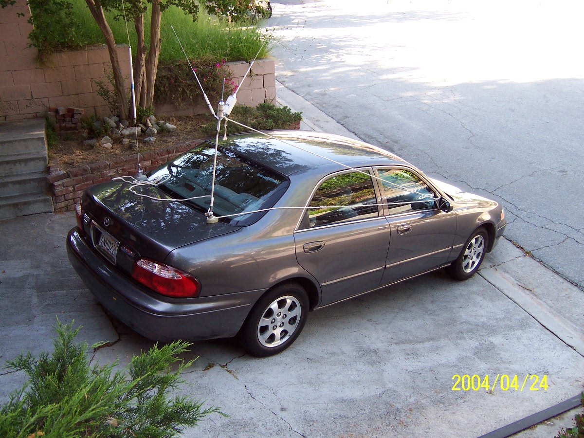
20/30/40 meter antenna roped down to prevent mechanical failure.


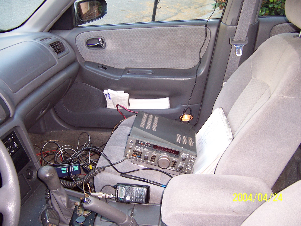
Driver's View.  GPS and APRS courtesy W0RPK.

Back to trip page